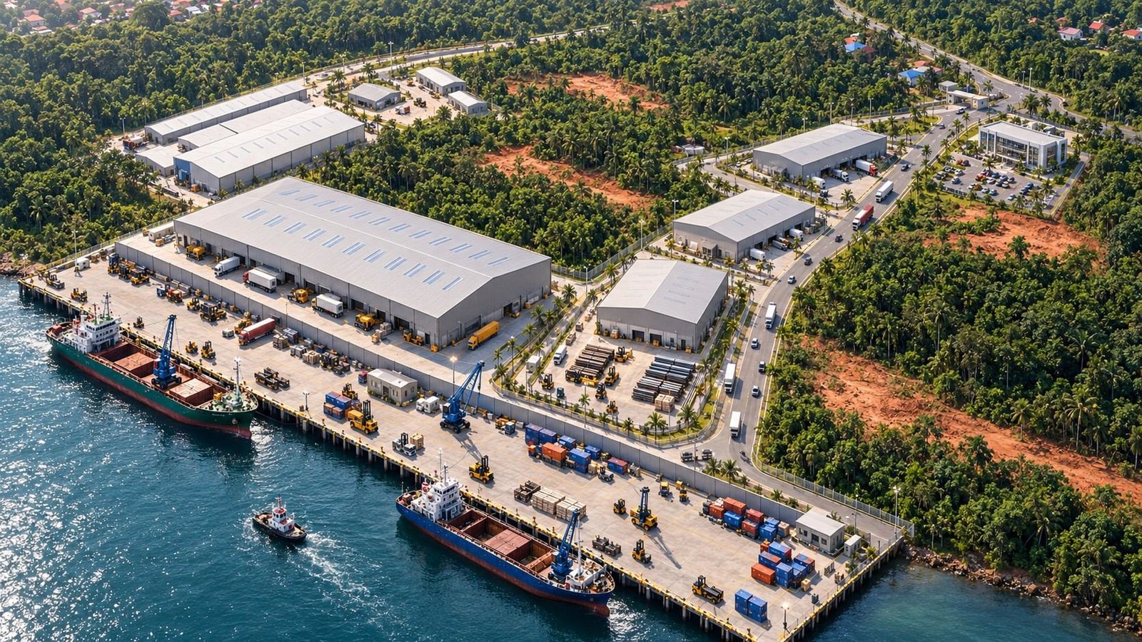
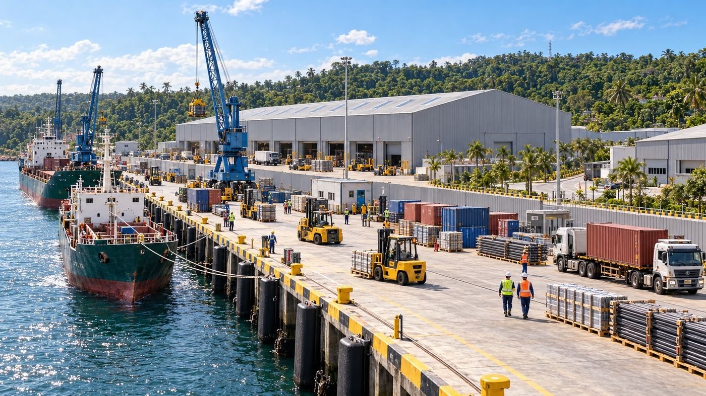
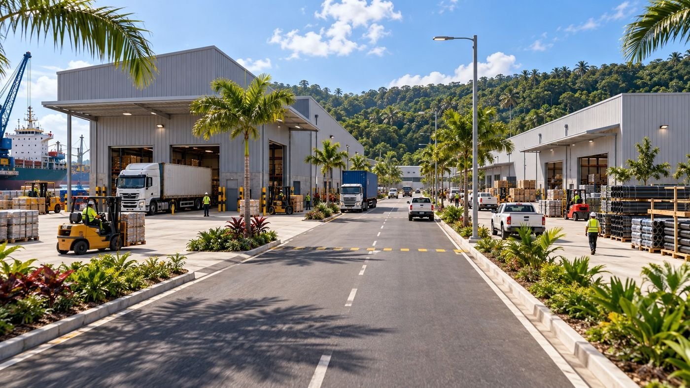
 Concept visualisation (AI) – not a photograph
A port estate on Balikpapan Bay
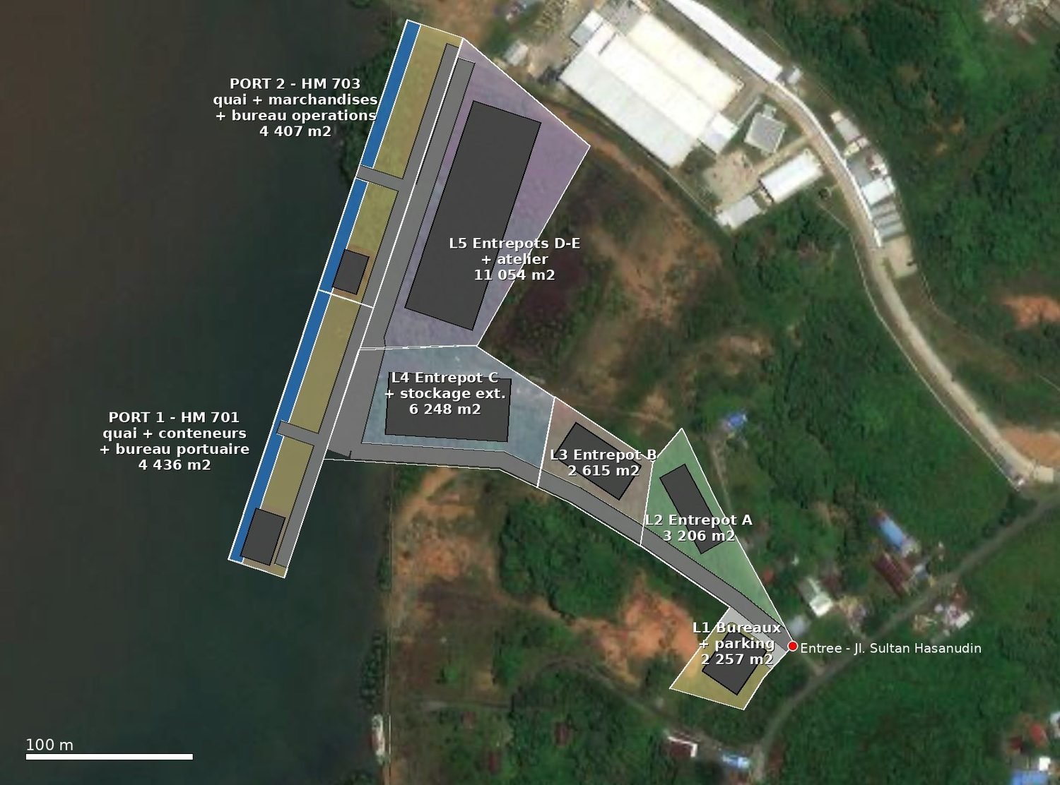
43,047 m² of titled dry land running from Jl. Sultan Hasanudin to the Kariangau shipping lane, with a master plan for two quays, warehouses and offices already drawn.
On the Kariangau shipping lane
The site sits on the west shore of Balikpapan, between an established industrial cluster to the north and the shipyards to the south, facing the lane used by vessels to Penajam and Mamuju.
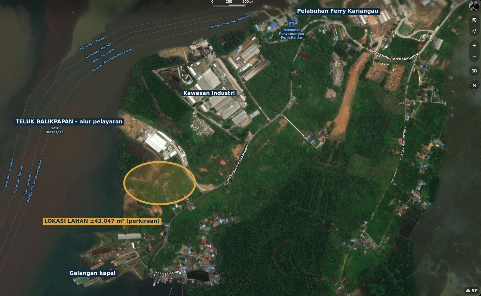
- NorthPT BUMA Rebuild Center Kariangau (mining heavy-equipment maintenance)
- SouthNeighbouring frontage already reclaimed and used for berthing; shipyards
- EastJl. Sultan Hasanudin, public road access
- WestBalikpapan Bay and the Kariangau shipping lane
- AreaKariangau Industrial Estate, KKT container terminal, Kariangau ferry port, Pertamina Balikpapan refinery
Six plots, one road-to-sea site
Four plots carry Hak Milik (freehold) certificates registered with BPN, Indonesia's land agency. Two further plots are covered by 2004 BPN survey certificates recording dry land.
| Plot | Document | Title | Area | Role in plan |
|---|---|---|---|---|
| 123 | NIB 02733 | Hak Milik | 6,557 m² | Road frontage – entrance, offices L1, warehouse A |
| 125 | NIB 02944 | Hak Milik | 3,385 m² | Centre – warehouse B |
| 122 | NIB 02942 | Hak Milik | 8,270 m² | Waterfront – warehouse C and open storage |
| 124 | NIB 02943 | Hak Milik | 12,975 m² | Waterfront, next to PT BUMA – warehouses D–E and workshop |
| M.701 | SU 14/Kariangau/2004 | Dry land | 5,930 m² | PORT 1 – quay and container yard |
| M.703 | SU 16/Kariangau/2004 | Dry land | 5,930 m² | PORT 2 – quay and general cargo |
| Total | 43,047 m² | |||
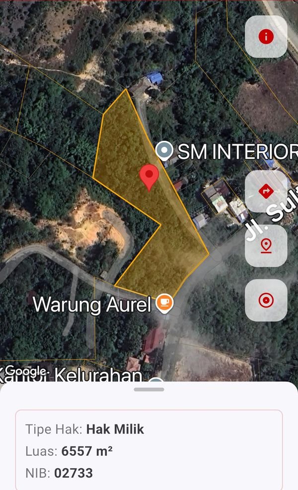
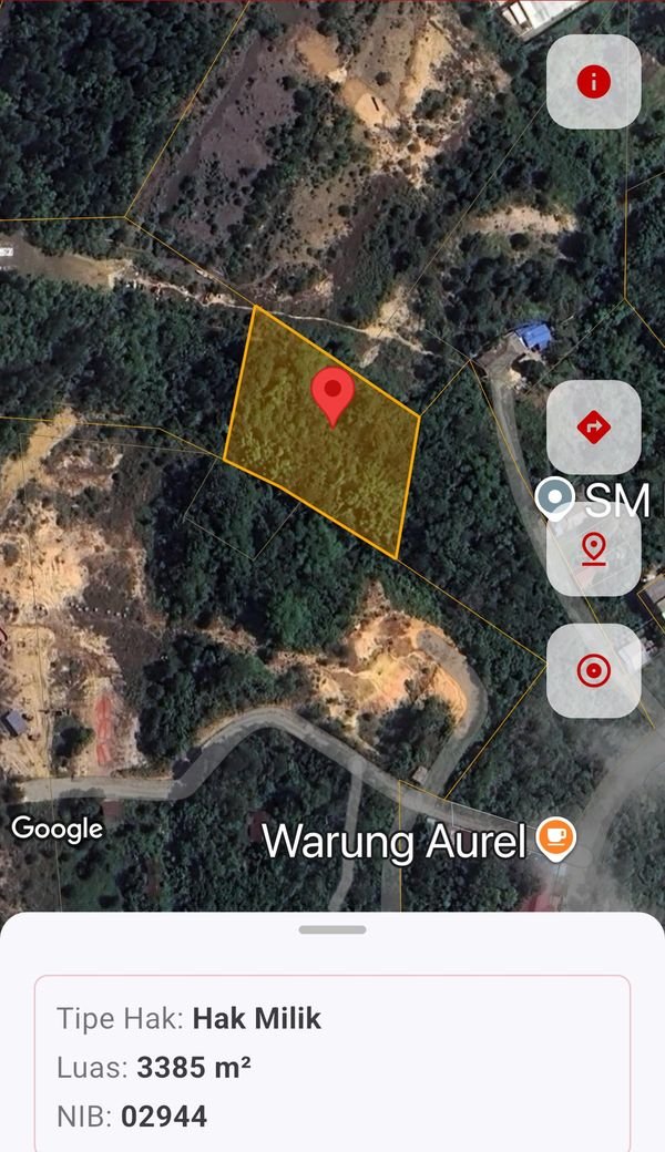
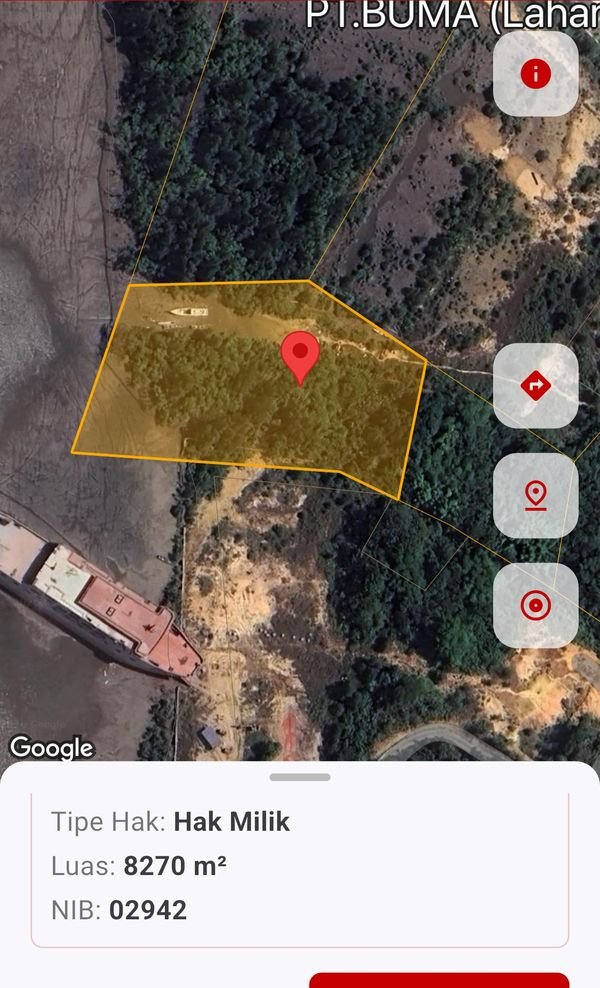
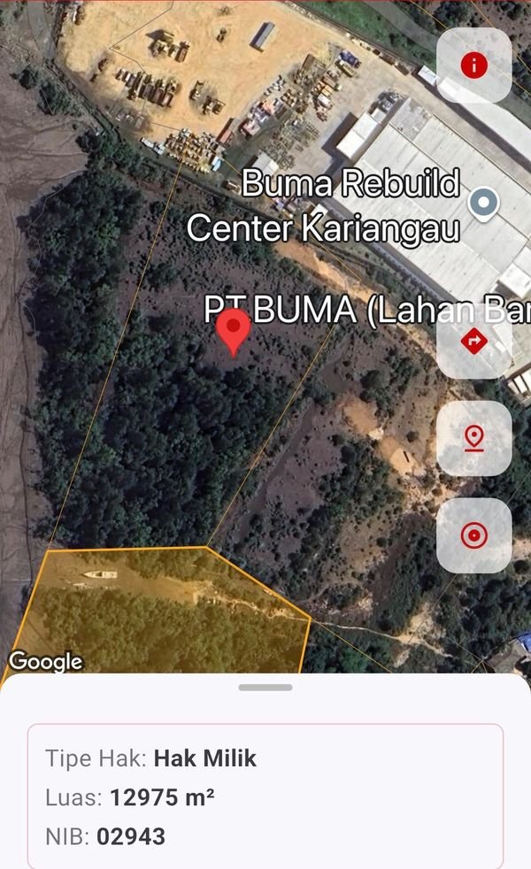
Source: BPN “Sentuh Tanahku” official app. Final areas follow BPN measurement at transaction.
Hak Milik can be held by Indonesian individuals. Companies, including foreign-owned PT PMA, acquire HGB (right to build) through the standard BPN process.
The estate is already designed
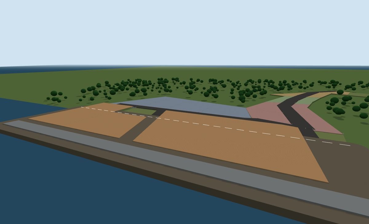
A 10 m estate road runs from the Jl. Sultan Hasanudin gate to two quay zones on the bay. Five lots between them take offices, warehouses and a workshop. The plan adapts to each buyer's or tenant's needs.
What the estate becomes
Concept visualisations of the completed estate, and the 3D land model the plan was built on.
Demand the site is built for
Refinery and energy
Pertamina's Balikpapan refinery upgrade and the oil, gas and mining service chain draw suppliers that need yards and quays.
A growing economy
Indonesia grows about 5% a year (IMF forecast 5.1% for 2026). Supply chains moving into Southeast Asia raise demand for waterfront industrial land.
Gateway to the new capital
Balikpapan is the logistics gateway to Nusantara via the Balikpapan–Samarinda toll road and its ports.
| Balikpapan asking rents, 2026 | Rp / m² / month |
|---|---|
| Modern warehouse, Kariangau industrial zone | 65,000 – 85,000 |
| Standard warehouse, city | 45,000 – 60,000 |
| Open yard / laydown | 25,000 – 35,000 |
Source: Brighton.co.id listings, September 2026. Indicative asking prices.
How to take a position
Send a written letter of intent. Shortlisted parties receive the certificates, survey documents and the 3D model, and are invited to a site visit.
Letter of intent
Identity, offered price, payment structure, proof of funds, intended use.
Documents and site visit
BPN certificates, survey certificates, master plan and 3D model.
Negotiation
Sale and purchase agreement (PPJB).
Due diligence and deed
BPN and zoning checks, then the deed before a PPAT land notary.
Information memorandum
The full memorandum: location, titles, site plan, visualisations, business model, land value and economic context. 16 pages.
Get in touch
Write to us by email or WhatsApp. We reply in English, Bahasa Indonesia and Korean.